Road distance of Rewa from:
| Allahabad | 130 KM | 3 Hour |
| Satna | 55 KM | 1 Hour |
| Khajuraho | 165 KM | 3.5 Hour |
| Jabalpur | 175 KM | 5 Hour |
| Bhopal | 500 KM | 12 Hour |
| Indore | 676 KM | 15 Hour |
| Bandhavgarh | 120 KM | 2.5 Hour |
| Sidhi | 80 KM | 2 Hour |
| Shahdol | 160 KM | 3 Hour |
| Katni | 140 KM | 3 Hour |
| Raipur(C.G.) | 460 KM | 12 Hour |
Significant waterfalls on the Tamas or Tons and its tributaries, as they come down from the Rewa Plateau, are: Chachai Falls (127m) on the Bihad River, a tributary of the Tamas, the Keoti Falls (98m) on the Mahana River, a tributary of the Tamsa, Odda Falls (145m) on the Odda River, a tributary of the Belah River, which is itself a tributary of the Tamsa, and Purwa Falls (70m) on the Tamsa or Tons
Location & Geographical Area
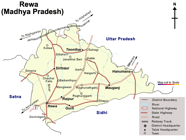
Rewa lies between 240 ° 18’ and 250 ° 12’ north latitudes and 810 ° 2’ and 820 ° 18’. The district is bounded on the north by Uttar Pradesh, on the east and southeast by Sidhi, on the south by Shahdol, and on the west by Satna. It is part of Rewa Division. It has an area of 6,240 km2.
Divisions in Rewa
Rewa district is divided in to 9 tehsils named Mangava, Naigarhi, Sirmaur, Jawa, Teonthar, Hanumana, Hujur, Raipur Karchulian and Mauganj, whereas Rewa city lies in Hujurs Tehsil. Top
Forests in and around Rewa
Rewa is very rich in Natural resources like forests (with total area of 3072.41 Sq. K.M), Wildlife and Minerals. Below are the forests in and around Rewa.
- Bandhavgarh National Forest
- Govindgarh
- Son Ghariyal
- Kuthuliya Forest
Rivers in and around Rewa
- Tons or Tamas
- Son
- Bichiya
- Beehar